Library:Virtual Museum
This page has been viewed {{#googleanalyticsmetrics: metric=pageviews|page=Library:Virtual_Museum|startDate=2014-07-01}} times.
Have you ever wanted to know more about the rooms in the Barber Centre? Below we highlight just a few of the rooms in the Irving K. Barber Learning Centre. The majority of the rooms in the are named after historical places in British Columbia, but as you'll see, some are named after people as well.
Atlin Meeting Room
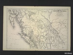
The town of Atlin and Atlin Lake are located along Highway 7, just south of the border with the Yukon. Atlin, often called “Switzerland of the North,” is known for its wintertime beauty and activities. The name Atlin is derived from the Tlingit word atlah, which means “big water.” [1] The town was founded in the late 19th century when gold was struck in the area, drawing thousands of settlers; today the population is around 450 people.
Bamfield Room

Located on the southwestern side of Vancouver Island, this historic community was named after William Eddy Banfield, who came out to the coast aboard H.M.S. Constance in 1846. He later became an Indian Agent and collected a large amount of ethnological information about the First Nations communities in the area. Forty years later Banfield Creek was chosen as the northern terminus of the 7,000 mile long submarine cable linking the British possessions in North America and the British Commonwealth of Australia, with the first message transmitted December 8, 1902. The following year the Bamfield Post Office was established, and although the spelling mistake was quickly acknowledged by postal authorities, corrected cancellation stamps were never issued to the Banfield Postmaster.
For the next fifty years, provincial and federal maps identified Bamfield Post Office on the shore of Banfield Inlet. The Bamfield Marine Station opened in 1972, on the site once occupied by the cable station. Parks Canada has installed a National Historic Site tablet here. [2]
Bella Coola Meeting Room

Bella Coola is a small town on the Central Coast of B.C. home to the Nuxalk Nation.[3]
The Bella Coola area is famous for the MacKenzie Rock, where in 1793 Alexander MacKenzie wrote his name on a rock to commemorate completing the first recorded journey across North America. In the early to mid 20th century, the Bella Coola area was home to the Tallheo Cannery, built in 1912 by the Canadian Fishing Company.[4]
In the Barber Centre, the Bella Coola room is located on the first floor of the building.
Chapman Learning Commons

The Chapman Learning Commons is named after Library benefactors Kay and Lloyd Chapman. Longtime supporters of UBC, the Chapmans have inspired innovative projects and programs that have improved the quality of life of students, faculty and the wider community.
Beginning in 1975, the Chapmans, UBC alums, have made a yearly gift to the library, focusing their efforts on inventive projects with the highest degree of impact. The proof of their desire to encourage innovative learning is on brilliant display in the Chapman Learning Commons in the Irving K. Barber Learning Centre.
Constructed in 2002, and reopened in 2008, the Chapman Learning Commons is an innovative space which encourages open discourse, group work and use of cutting-edge technology. Located in the heritage section of the former Main Library (now the Irving K. Barber Learning Centre), the Learning Commons has soaring ceilings, stained glass windows, and comfortable and spacious furniture. It is also home to an array of community events and lectures and student resources to aid in the learning experience including a laptop-lending program and a tutoring centre.[5]
To find out more about the Chapman Learning Commons, or to learn more about the innovative programs at the Irving K. Barber Learning Centre, visit their website.
Chilcotin Board Room
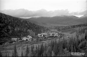
Chilcotin, meaning "people of the red river," refers to the Chilcotin Plateau region in British Columbia, and to the Chilcotin (Tsilhqot'in) people. The Chilcotin (Tsilhqot'in) First Nation are a Dene (Athapaskan)[6] speaking people who live between the Fraser River and the Coast Mountains in west-central BC. The BC Geographical Names database [7] adds that the word "chilcotin" can also be translated as "ochre river people." Ochre, a mineralized substance (usually red or yellow), can be used as a base for paint or dyes. Ochre is used by many First Nations peoples even today.
In 1808 explorer Simon Fraser was the first European to encounter the Chilcotin people, or "Chilk-hodins" as he called them.[8]
The Hudson's Bay Company established an outpost in Chilcotin territory shortly after in 1827. The outpost closed in 1844. In 1859, gold miners proliferated on the banks of the Fraser River. The Chilcotin suffered heavy population loss in a smallpox epidemic shortly thereafter.[9]
Chung Room and Collection

From a young age, Wallace Chung had an affinity for discovery, collecting, and preserving. What began as a scrapbook of newspaper clippings and pictures from magazines became an assembly of over 25,000 rare and unique items. The collection was donated to UBC Library in 1997. The Chung Collection is now regarded as one of Canada’s national treasures and is of special importance in documenting the history of the CPR and the Chinese-Canadian experience.1 These priceless personal and historical artifacts amassed over a remarkable lifetime are now on permanent display in the Rare Books and Special Collections Chung Exhibition Room.
Dr. Chung's passion for collecting is evident in the dedication and dynamics behind the Chung Collection, which has three main themes: early B.C. history, immigration and settlement, and the Canadian Pacific Railway Company. The Chung Collection includes many rare and unique items: documents, books, maps, posters, paintings, photographs, silver, glass, ceramic ware and other artifacts. It is one of the most exceptional and extensive collections of its kind in North America.
Golden Inheritance: The Wallace B. Chung and Madeline H. Chung Collection at UBC Library, a recent book produced by UBC Library, provides an overview of Dr. Chung and his family, and the importance of the collection.[10] [11]
To learn more about the Chung Collection, or to explore the exhibit at the Irving K. Barber Learning Centre, visit the Chung Collection website. You can also explore the Chinese Experience in B.C. website to learn more about the collection.
Columbia River Room
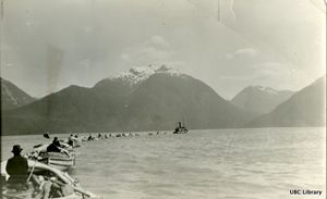
The Columbia River originates in the B.C. Rocky Mountains and flows down to the Pacific Ocean just north of Portland, Oregon. The river was named in 1792, by Captain Robert Gray of Boston, after his ship "Columbia."[12] Gray also named several landmarks in the area, but many were subsequently renamed. His success in navigating the river would eventually be the basis for U.S. territorial claims to the Oregon Country.[13]
Dodson Room

The Dodson Room was named after benefactors Suzanne Cates Dodson and Earl Dodson. UBC Library has long played an important role in their personal and professional lives. The pair first met at the Main Library (now the Irving K. Barber Learning Centre) back in the 1950s when they were both members of the Biology Club. Suzanne went on to work at the Library until her retirement in 1999.
In recognition of the Dodsons’ unwavering support of UBC Library, a restored reading room was named in their honour. Once a part of the former Main Library, the Suzanne Cates Dodson and Earl D. Dodson Reading Room is now located within the Chapman Learning Commons in the Irving K. Barber Learning Centre. The 1999 renovations rebuilt the room to its former 1925 glory with replicas of the only two remaining wrought iron and glass lamps that hung in the Main Library’s front hall, refinished wooden roof beams, and a hand-painted decorative frieze of Celtic design by UBC artists.[14]
Fernie Reading Room
Located in the East Kootenay region of British Columbia, Fernie is nearer to Alberta than it is to the rest of the province. Known as ¢aqahak to the Ktunaxa[15], Fernie was named for William Fernie, a gold prospector, coal miner and later government agent. [16] The town's main industry was and still is coal mining. Completely encircled by the Rocky Mountains, skiing and winter tourism is also popular.
In the Barber Centre, the Fernie Reading Room is number 380, and is a study area for the use of students in the UBC Gateway Programs: Arts One, Science One, Coordinated Arts and Coordinated Science.
Fraser River Room

The Fraser River is, not surprisingly, named after the explorer Simon Fraser who fully explored the river in 1808. The longest river in British Columbia (over 2,200 km), it originates in the Rocky Mountains and flows into the Straight of Georgia.[17] With the most productive salmon fishery in the world, the Fraser River has been a focal point of culture for centuries. The river was the site of its first recorded settlements of Aboriginal people (see Musqueam, Sto:lo, St'at'imc, Secwepemc and Nlaka'pamux), the route of multitudes of prospectors during the Fraser Canyon Gold Rush and the main vehicle of the province's early commerce and industry. The river has been designated a Canadian Heritage River for its natural and human heritage.[18]
Golden Jubilee Room
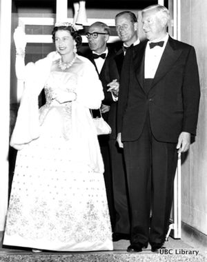
In 2002, Queen Elizabeth II became the second-longest reigning monarch in British history, celebrating 50 years on the British throne. Despite the deaths of her sister, Princess Margaret and her mother, Queen Elizabeth, the Queen Mother, in February and March of 2002 respectively, Queen Elizabeth II and her husband, Prince Phillip, undertook an international tour in which she “express[ed] her thanks to people, both personally and officially, for their support and loyalty over her reign.”[19]
As part of that tour, Queen Elizabeth and Prince Phillip visited the University of British Columbia in October, 2002. They had visited Canada the campus three times before, in 1951, 1959 and 1983. To view digitized photographs of their previous visits, please take a look at the University Archives virtual display, Royal Visits to the UBC Campus.
During her 2002 visit to UBC, the Queen unveiled a plaque commemorating her visit and celebrating the naming of a room on the fourth floor of the Irving K Barber Learning Centre, the Golden Jubilee Room.
Gold River Room

Located on the northeastern side of Muchalat Inlet in the Nootka Sound, Gold River is a village municipality located close to the geographic centre of Vancouver Island in British Columbia, Canada. Gold River developed in 1967 as a prototypical logging and pulp and paper industry community. Gold River quickly sprang into prosperity and established excellent community facilities. The village has attempted to capitalize on its idealistic setting among picturesque mountains, lakes, rivers, ocean, and forests to develop tourism and sport fishing as its main economic supports. [20]
Hartley Bay Meeting Room

Hartley Bay is the home of the Gitga’at First Nation, members of the Tsimshian cultural group. A village of 200, accessible only by air or water, Hartley Bay is located at the mouth of Douglas Channel, about 630 kilometres north of Vancouver and 145 kilometres south of Prince Rupert.[21] The Tsimshian, whose name means “Inside the Skeena River,” live in southern Alaska and around Terrace and Prince Rupert, BC. [22]
On March 22, 2006, the people of Hartley Bay were the first responders to the passengers aboard the sinking BC Ferries Queen of the North. The community was recognized for their heroic actions by the Governor General on May 3, 2006 and received the Governor General’s Commendation for Outstanding Service.
UBC's Xwi7xwa Library, the only aboriginal branch of a university library in Canada, has a variety of material on the community of Hartley Bay, including material in their special collections. Visit their website for more information on accessing material in the special collections.
Keremeos Lounge
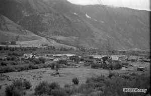
Keremeos is a village in the Southern Interior, originally populated by the Similkameen people of the Syilx, or Okanagan First Nation. The name Keremeos originated from the Similkameen dialect of the Okanagan language word "Keremeyeus" meaning "creek which cuts its way through the flats" referring to Keremeos Creek. Keremeos is the only First Nations place name in the Interior that contains the letter "r." [23] The Okanagan language, Syilx'tsn, is part of the Interior Salishan linguistic group.[24]
Hudson's Bay Company established a trading post in 1860, after Fort Okanogan (in American territory) was closed. The Keremeos HBC post closed in 1872.[25]Keremeos was adopted as a town in 1936 by the BC Geological Survey.
Kootenay River Room

The Ktunaxa (pronounced ‘too-nah-ha’) people, formerly called the Kootenay or Kootenai, have occupied the lands adjacent to the Kootenay and Columbia Rivers and the Arrow Lakes of B.C. for more than 10,000 years.[26] The Kootenay River, named after the people, was called “McGillivray’s River” in the early 19th century after a European explorer, David Thompson, surveyed the river banks.[27] In 1864, the river was officially noted as the Kootenay River by the Geographic Board of Canada [28]
Lillooet Room

In the Irving K. Barber Learning Centre, the Lillooet Room is part of the Chapman Learning Commons.
The town of Lillooet was founded as “Mile 0″ on the Cariboo/Barkerville gold rush wagon trail. Located 340 km northeast of Vancouver, Lillooet is included in the traditional land of the St’at’imc First Nation. After the Gold Rush period, the main industries in Lillooet were centered around the railway, ranching, farming and forestry.[29] Both the St'at'imc First Nation and the Lil'wat Nation share the Ucwalmicwts (St’at’imc) language group.[30]
Moresby Classroom

Moresby Island is part of Haida Gwaii (formerly known as the Queen Charlotte Islands), a remote archipelago in northern B.C. Often called “the Galapagos of the north,” Haida Gwaii is home to distinct flora and fauna. Moresby Island is named for Admiral Fairfax Moresby [31], but the traditional name in the Haida language is Gwaii Haanas.[32]
Namu Meeting Room

Namu is a small port town located in northern B.C. Just south of Bella Bella, the town was a former cannery site, which closed in the 1980s. The Heiltsuk First Nation is now attempting to clean up the area, which still contains industrial waste with old fuel tanks and buildings still on-site.[33]
Parliamentary Room
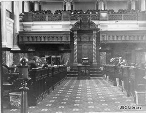
Every August 1, British Columbians celebrate British Columbia (BC) Day, a civic holiday. According to the Protocol and Events Branch of the British Columbia government, the “British Columbia Day Act, R.S.B.C. 1996 c.34 was first introduced in 1974 as Bill 61 by the Hon. Ernie Hall, the Provincial Secretary under Premier Dave Barrett. The explanatory notes prefacing the bill states: “The purposes of this Bill is to recognize the pioneers of British Columbia by declaring the first Monday of August in each year to be a public holiday known as British Columbia Day.”
The decision to make BC a holiday was debated during the 4th session of the 30th Parliament in 1974. This debate took place in the chamber of the British Columbia Parliament building.[34]
The Parliamentary Room in IKBLC was modeled after a room in the British Columbia Parliament. This room is quite different from a traditional lecture hall and is intended to support collaborative student learning and debate.
Peace River Room

The Peace River originates in the Rocky Mountains of British Columbia and flows into Northern Alberta.
Peter Pond's maps of 1785 and 1787 refer to it as the "River of Peace." Other names have included Un-ja-ga/Unjigah, as recorded by explorer Sir Alexander Mackenzie (1764-1820), in his "Voyage to the Pacific Coast of Canada" in 1793. The exact original meaning of the word "Unjaga" is not certain[35].
The name "Peace River" was formally adopted in June 1912, along with the approved French form, "Rivière de la Paix."
The Peace River area is the traditional home of the Danezaa people - historically referred to as the Beaver tribe by European explorers. The Danezaa language is part of the Athapaskan language group, the second largest language family in North America.[36].
Qualicum Room
[[File:Qualicum Beach, BC C.P.R. railroad station.jpg|thumb|University of British Columbia Library, CC-PH-02398, Qualicum Beach]
Qualicum Beach is located outside of Nanaimo, on Vancouver Island. The name "Qualicum" comes from a Pentlatch language term that means "Where the dog salmon (chum salmon) run."[37] After a smallpox epidemic in 1862, the area was abandoned for many years, with settlers arriving in the 1860s.[38]
In the Barber Centre, the Qualicum Reading Room is room 305, the large, open study space at the top of the main stairs on the third floor, just outside the Chapman Learning Commons. This is a very popular space for studying and is also where the Chapman Learning Commons-AMS tutoring takes place.
Ridington Room
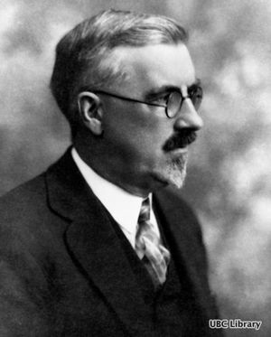
The Ridington Room is named after an important person in the history of the University of British Columbia Library: John Ridington.
John Ridington was UBC’s first University Librarian. A former journalist and teacher, he started work on the library collection in August 1914 when UBC was in its temporary home at West 10th Avenue and Laurel Street (the Fairview Shacks). By 1916, he had been appointed University Librarian, a position he remained in until his retirement at the age of 72 in April 1940. According to information gathered by the UBC Archives, Ridington was known as a rigid authoritarian and was nicknamed ‘King John.’
The University Archives is responsible for collecting material related to the University and, therefore, holds the papers of John Ridington and his family. If you are interested in learning more about the life of UBC’s first University librarian, take a look at the finding aid (“an aid for finding items in an archival collection”) to the collection that is available on the University Archives website.
The Ridington Room is definitely worth a visit if you haven’t already had the oppportunity to see the space. It is often called the “Harry Potter Room” by students, due to the winding staircase and the portrait-covered walls. A portrait of John Ridington, painted in 1912 by his brother-in-law Malcolm Charleston, hangs in the Ridington Room.
There is also a magnificent art installation by Vancouver artist John Nutter, who was commissioned by Jean Barber to to design a 45-panel glass sculpture that is intended to “flow like the Northern Lights,” and features intricate etchings designed around a series of compasses. Nutter felt the Library, like a compass, should be used “as a tool of discovery.” An ideal space for quiet study, the room is a hit with students and visitors alike[39].
Skeena River Room

The Skeena River Room is named after the Skeena River, the second-longest river entirely within British Columbia’s borders (the largest being the Fraser River). Six-hundred and twenty-one kilometers long, it flows south and west through the Skeena and Coast Mountains, reaching the Pacific Ocean at Prince Rupert.
For thousands of years, the Tsimshian (“People of the Skeena”), Gitxsan and Nisga'a have lived along the river.[40] Today there are approximately 10,000 Tsimshian living around the Skeena.
George Vancouver visited the mouth of the Skeena River in July 1793, but it wasn’t until the 1860s that the Gold Rush and railway brought more settlers along the river. In 1876, salmon canneries were built along the Skeena River - at one time there were as many as 18 canneries.
Stewart Meeting Room

Stewart, B.C. is a border town near the end of the Portland canal and the border of Alaska. Forestry and mining are the two main industries of the area, mining being what prompted white settlers to the area in 1898. The Nisga’a First Nation called the Stewart area Skam-A-Kounst, meaning “safe house” or “strong house.” Stewart is named for the Stewart brothers from Victoria, who held interests in a number of mines in the area at the turn of the century. [41]
Stikine Room
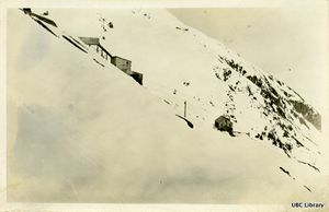
The Stikine River is in northwestern B.C., emptying into the ocean in southeastern Alaska. The river and its surroundings are considered to be an important piece of B.C. wilderness to preserve. If you search the library catalogue for the keyword Stikine, you will find a number of publications related to the preservation of this area.
Like many names of rivers and places, there have been variations of spelling in the name “Stikine” over time, including Shikene, Stachine, Stachin, Stah-Keena, Stahkin, Stakeen, Stickeen, Stickienes, Stikeen, Stikin, and Sucheen![42]. However, like many place names, it was also known under completely different names. B.C. Geographical Names confirms that the Stikine was known by other names at different times- they cite St. Francis River, as well as Pelly’s River.
In the Barber Centre, the Stikine Room is room 260, currently the office for Enrolment Services.
Thompson Meeting Room

The Thompson Meeting Room is named after David Thompson, Canada’s great geographer, who surveyed for the Hudson’s Bay Company from 1816 to 1826. The explorer Simon Fraser gave the name to the area in tribute to Thompson, although Thompson himself never visited the any of the three Thompson Rivers in B.C.[43]
Thompson River Room

The Thompson River is located near Kamloops, B.C. before it splits into the North and South Thompson rivers. Named after David Thompson, a Canadian geographer, the river is the largest tributary of the Fraser River.[44] Thompson himself lived near Invermere, B.C., some 480 kilometres east of the Thompson Rivers.
Tofino Room
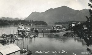
Located on the west coast of Vancouver Island, Tofino is the home of the world-famous Pacific Rim National Park and beautiful Long Beach. Major industries have traditionally included fishing and forestry, and in recent decades of course tourism, as visitors flock to the resorts and beaches in all seasons.
A number of photographs of this region in UBC Library's digital collection are from the Chung Collection, held in Rare Books and Special Collections. The Chung Collection holds 8,000 historic photographs, many showing various locales in British Columbia.[45]
In the Irving K. Barber Learning Centre, the Tofino Meeting Room is number 156.
Ucluelet Meeting Room
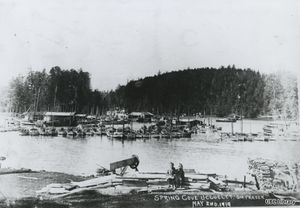
Ucluelet is located on the west coast of Vancouver Island. The name means “people of the safe harbor” in Nuu-chah-nulth language. The Nuu-chah-nulth people, comprised of many different nations, have inhabited the area for more than 10,000 years. The Yuułuʔiłʔatḥ Nation and Toquaht Nation currently live in the Ucluelet area. At the end of beautiful Long Beach, the area is a mecca for tourists.[46]
Victoria Learning Theatre

The Victoria Learning Theatre is named after the city of Victoria.
On the southern tip of Vancouver Island, Victoria is our province’s capital and hence the place of many events in the province’s history. Rare Books and Special Collections contains almost innumerable books, maps, documents, and photographs related to Victoria. However, to rare books enthusiasts, there is one (or two) events from Victoria’s history that are of particular note: the publication of the first book (or books) to be printed in British Columbia.
What is largely accepted to be the first book printed in B.C. is Order in council constituting the Supreme Court of Civil Justice of Vancouver Island and rules of practice and forms to be used therein, which basically amounted to a 'rule book' for the Supreme Court in Victoria. It was printed at the Victoria Gazette in November 1858.
The library copy is particularly special: it was David Cameron‘s personal copy! David Cameron was the first Chief Justice of the Supreme Court of British Columbia- in other words, not only did he own the book, he wrote the book too. This copy was given to the Library by Dr. Wallace Chung, on the occasion of the re-opening of the Chung Collection in Spring 2008. David Cameron’s signature can be seen on the cover, and on the Act to provide for the Administration of Justice in Vancouver’s Island, tipped in the front [47]
Yukon Meeting Room

The Yukon Meeting Room is named after the territory of Yukon, established in 1898. The Yukon is named after the Yukon River, one of the longest rivers in North America. The original name was Yu-kan-ah, which means “great river” in an Athabaskan dialect. The Dinjii Zhuu people, formerly called the Gwichi’in. currently live in the Northwest Territories, Yukon and northern Alaska.
Allison Harbour

Allison Harbour the place is a harbour in the Queen Charlotte Straight, as well as a marine park. Allison Harbour was formerly known as False Bay or False Schooner Passage. Extending north from Queen Charlotte Strait to the southeast of Bramham Island, it is the site of the former post office and steamer landing of Allison Harbour, British Columbia. The Allison Reefs lie in the entrance to the sound; Allison Cone (185m), which is nearby between Shelter Bay and Cape Caution, was named in association with Allison Harbour.
Clearwater

Clearwater is a district municipality in the North Thompson River valley in British Columbia, Canada, where the Clearwater River empties into the North Thompson River. The Overlanders expedition to the Cariboo goldfields rafted down the North Thompson River in 1862. When they first arrived at the mouth of the Clearwater River, they named it for its distinct clarity compared to the relatively muddy waters of the North Thompson.
McBride

The Village of McBride is located in the Robson Valley region of British Columbia, Canada. The Village is located 210 km (130 mi) southeast of Prince George, British Columbia and 166 km (103 mi) west of Jasper, Alberta. Incorporated in 1932, McBride is a community with a variety of natural beauty surrounding the Village. McBride was founded in 1913 as Mile 90 of the Grand Trunk Pacific Railway. The Village received its name after the serving premier, Sir Richard McBride. McBride’s early industries were rail, shipping, forest harvesting and agricultural development of the valley. McBride is rich in farmland in the valley bottom, with a mix of forest and alpine surrounding the Valley. This unique mixture allows McBride to be a prime location for many industries. Current industries for McBride include railroad, forest, tourism, agriculture and small businesses.
References:
- ↑ BC Geographical Names Database. "Atlin." http://apps.gov.bc.ca/pub/bcgnws/names/40235.html
- ↑ BC Geographical Names Database. "Bamfield." http://apps.gov.bc.ca/pub/bcgnws/names/11066.html
- ↑ Nuxalk Smayusta. "Territory and Maps." http://www.nuxalk.net/html/maps.htm
- ↑ BC Geographical Names Database. "Bella Coola." http://apps.gov.bc.ca/pub/bcgnws/names/3350.html
- ↑ The Chapman Learning Commons. http://support.library.ubc.ca/stories-of-support/community/chapman-learning-commons/
- ↑ Lewis, M. Paul (ed.), 2009. Ethnologue: Languages of the World, Sixteenth edition. Dallas, Tex.: SIL International. Online version: http://www.ethnologue.com/show_family.asp?subid=611-16
- ↑ BC Geographical Names Database. http://apps.gov.bc.ca/pub/bcgnws/names/5858.htm
- ↑ Akrigg, Helen B. and Akrigg, G.P.V. "British Columbia Place Names." University of British Columbia Press 1997
- ↑ Lane, Robert Lane. "Chilcotin-Tsilhqotin." Canadian Encyclopedia Online. http://www.thecanadianencyclopedia.com/articles/chilcotin-tsilhqotin.
- ↑ UBC Library. Drs. Wallace and Madeline Chung. http://support.library.ubc.ca/stories-of-support/drs-wallace-and-madeline-chung/
- ↑ http://resolve.library.ubc.ca/cgi-bin/catsearch?bid=6392352
- ↑ BC Geographical Names database. "Columbia River." http://apps.gov.bc.ca/pub/bcgnws/names/37961.html
- ↑ Lockley, Fred (1929). "Oregon Trail Blazers." New York, NY: The Knickerbocker Press. p. 369pp. LCCN 29030534.
- ↑ UBC Library. The Dodsons: Champions of UBC Library. http://support.library.ubc.ca/stories-of-support/dodson/
- ↑ FirstVoices. "Nature / Environment - place names: words." Ktunaxa. http://www.firstvoices.com/en/Ktunaxa/word-category/1f2fd0f8542dbe9f/--Nature--Environment---place-names
- ↑ Akrigg, Helen B. and Akrigg, G.P.V. British Columbia Place Names. University of British Columbia Press, 1997. http://resolve.library.ubc.ca/cgi-bin/catsearch?bid=2115253
- ↑ BC Geographical Names database. Fraser River. http://apps.gov.bc.ca/pub/bcgnws/names/40586.html
- ↑ Canadian Heritage River System. Fraser River. http://www.chrs.ca/Rivers/Fraser/Fraser-F_e.php
- ↑ Katherine Kalsbeek. Featured room: Golden Jubilee Room, from the New at Rare Books and Special Collections blog. http://blogs.ubc.ca/rbscnew/2012/04/17/featured-room-golden-jubilee-room/
- ↑ BC Geographical Names database. Gold River. http://apps.gov.bc.ca/pub/bcgnws/names/9765.html
- ↑ Katherine Kalsbeek. Featured Place: Hartley Bay, from the "New at Rare Books and Special Collections blog." http://blogs.ubc.ca/rbscnew/2011/05/03/featured-place-hartley-bay/
- ↑ www.tfntreaty.ca
- ↑ (BC Historical Quarterly, Vol 2, p 77.), Provincial Archives of BC "Place Names File" compiled 1945-1950 by A.G. Harvey
- ↑ www.syilx.org
- ↑ BC Geographical Names Database. http://apps.gov.bc.ca/pub/bcgnws/names/3779.html
- ↑ Ktunaxa. Who we are. http://www.ktunaxa.org/who-we-are/. see also: http://www.ktunaxa.org/who/popup_tradterritorymap.html
- ↑ Katherine Kalsbeek. New at Rare Books and Special Collections Blog. http://blogs.ubc.ca/rbscnew/2011/04/05/featured-place-kootenay-river/
- ↑ BC Geographical Names Database. http://apps.gov.bc.ca/pub/bcgnws/names/6263.html
- ↑ Sarah Romkey. Featured Place: Lillooet, from the "New at Rare Books and Special Collections blog." http://blogs.ubc.ca/rbscnew/2011/05/03/featured-place-hartley-bay/
- ↑ Lil'wat Nation. "Our language." http://www.lilwat.ca/lilwat7ul/our-language/
- ↑ Rare Books and Special Collections blog. http://blogs.ubc.ca/rbscnew/2010/11/16/167/
- ↑ Haida Nation. http://www.haidanation.ca/Pages/history/haidanation.html
- ↑ Globe and Mail. "The Namu lands of British Columbia." http://www.theglobeandmail.com/news/news-video/video-how-polluted-are-the-namu-lands-of-british-columbia/article19376722/
- ↑ Katherine Kalsbeek. Featured room: Parliamentary Room, from the "New at Rare Books and Special Collections blog." http://blogs.ubc.ca/rbscnew/2011/07/28/featured-room-parliamentary-room/
- ↑ BC Geographical Names Database. "Peace River." http://apps.gov.bc.ca/pub/bcgnws/names/6874.html
- ↑ Lewis, M. Paul (ed.), 2009. Ethnologue: Languages of the World, Sixteenth edition. Dallas, Tex.: SIL International. Online version: http://www.ethnologue.com/show_family.asp?subid=611-16
- ↑ Francis (ed), Daniel (2000). "Encyclopedia of British Columbia." Harbour Publishing. p. 585. ISBN 1-55017-200-X.
- ↑ Mackie, Richard. "The Wilderness Profound, Victorian Life on the Gulf of Georgia." Victoria, BC: Sono Nis Press, 1995. http://resolve.library.ubc.ca/cgi-bin/catsearch?bid=1076124
- ↑ Katherine Kalsbeek. Featured room: Ridington room, from the "New at Rare Books and Special Collections blog" http://blogs.ubc.ca/rbscnew/2011/01/26/featured-room-ridington-room/
- ↑ Canadian Museum of History. From Time Immemorial: Tsimshian Prehistory. http://www.historymuseum.ca/cmc/exhibitions/aborig/tsimsian/intro00e.shtml
- ↑ Sarah Romkey. Featured room: Stewart, BC, from the "New at Rare Books and Special Collections blog" http://blogs.ubc.ca/rbscnew/2011/10/13/featured-place-stewart/
- ↑ BC Geographical Names Database. http://apps.gov.bc.ca/pub/bcgnws/names/7821.html
- ↑ BC Geographical Names Database. "Thompson River." http://apps.gov.bc.ca/pub/bcgnws/names/40908.html
- ↑ GeoBC: British Columbia Geographical Names database. "Thompson River." http://apps.gov.bc.ca/pub/bcgnws/names/40908.html
- ↑ Sarah Romkey. Featured room: Tofino, from the "New at Rare Books and Special Collections blog" http://blogs.ubc.ca/rbscnew/2011/08/10/featured-place-tofino/
- ↑ Ucluelet. http://ucluelet.ca/community/the-ucluelet-experience/history-ucluelet-bc-canada-vancouver-island-west-coast-first-nations
- ↑ Katherine Kalsbeek. Featured place: Victoria, from the "New at Rare Books and Special Collections blog" http://blogs.ubc.ca/rbscnew/2012/03/02/featured-place-victoria/