File:Vancouver Transit Map.jpg
No higher resolution available.
Vancouver_Transit_Map.jpg (595 × 391 pixels, file size: 120 KB, MIME type: image/jpeg)
Summary
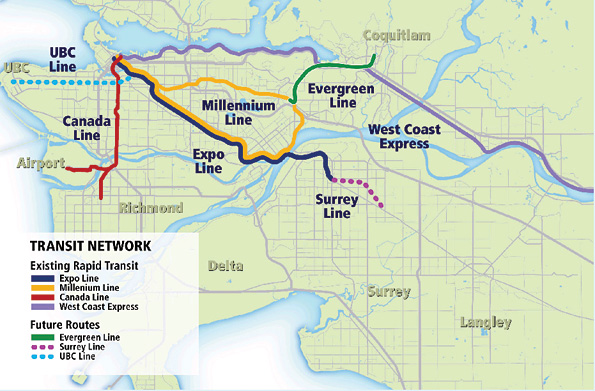
| Description | English: This is a map of rapid transit network in the Lower Mainland and where the new Evergreen line will fit in to that network. |
| Date | 18 October 2012 |
| File source | http://www.tc.gc.ca/eng/policy/anre-menu-3021.htm |
| Author | Transport Canada |
Licensing
|
|
File history
Click on a date/time to view the file as it appeared at that time.
| Date/Time | Thumbnail | Dimensions | User | Comment | |
|---|---|---|---|---|---|
| current | 01:35, 19 October 2012 | | 595 × 391 (120 KB) | Nlepan (talk | contribs) |
You cannot overwrite this file.
File usage
The following page uses this file: