File:Detroit Segregation Map.jpg
No higher resolution available.
Detroit_Segregation_Map.jpg (500 × 500 pixels, file size: 146 KB, MIME type: image/jpeg)
Summary
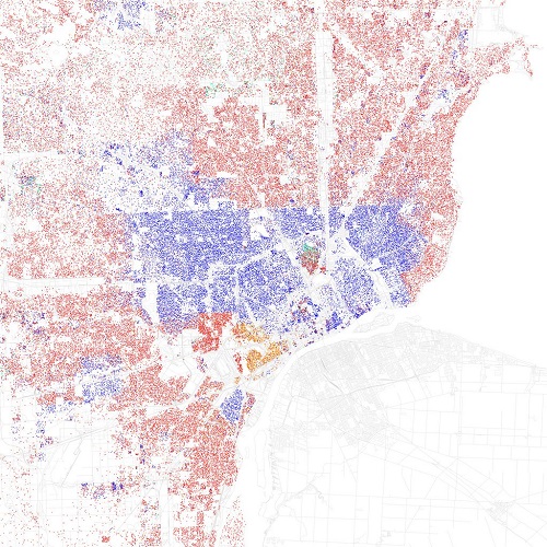
| Description | English: A map from the 2010 Consensus showing segregation by neighbourhood still exists in Metro Detroit.
Red is White, Blue is Black, Green is Asian, Orange is Hispanic, Yellow is Other, and each dot is 25 residents. |
| Date | 5 August 2016 () |
| File source | http://www.flickr.com/photos/walkingsf/5560480146/sizes/o/in/set-72157626354149574/ |
| Author | Eric Fischer |
Licensing
{{subst:uwl}}
File history
Click on a date/time to view the file as it appeared at that time.
| Date/Time | Thumbnail | Dimensions | User | Comment | |
|---|---|---|---|---|---|
| current | 02:16, 6 August 2016 | | 500 × 500 (146 KB) | FaisalPaktian (talk | contribs) | User created page with UploadWizard |
You cannot overwrite this file.
File usage
The following page uses this file: