File:Vancouver de.png
Size of this preview: 800 × 574 pixels. Other resolutions: 320 × 230 pixels | 640 × 459 pixels | 1,024 × 735 pixels | 1,280 × 919 pixels | 1,666 × 1,196 pixels.
Original file (1,666 × 1,196 pixels, file size: 4.02 MB, MIME type: image/png)
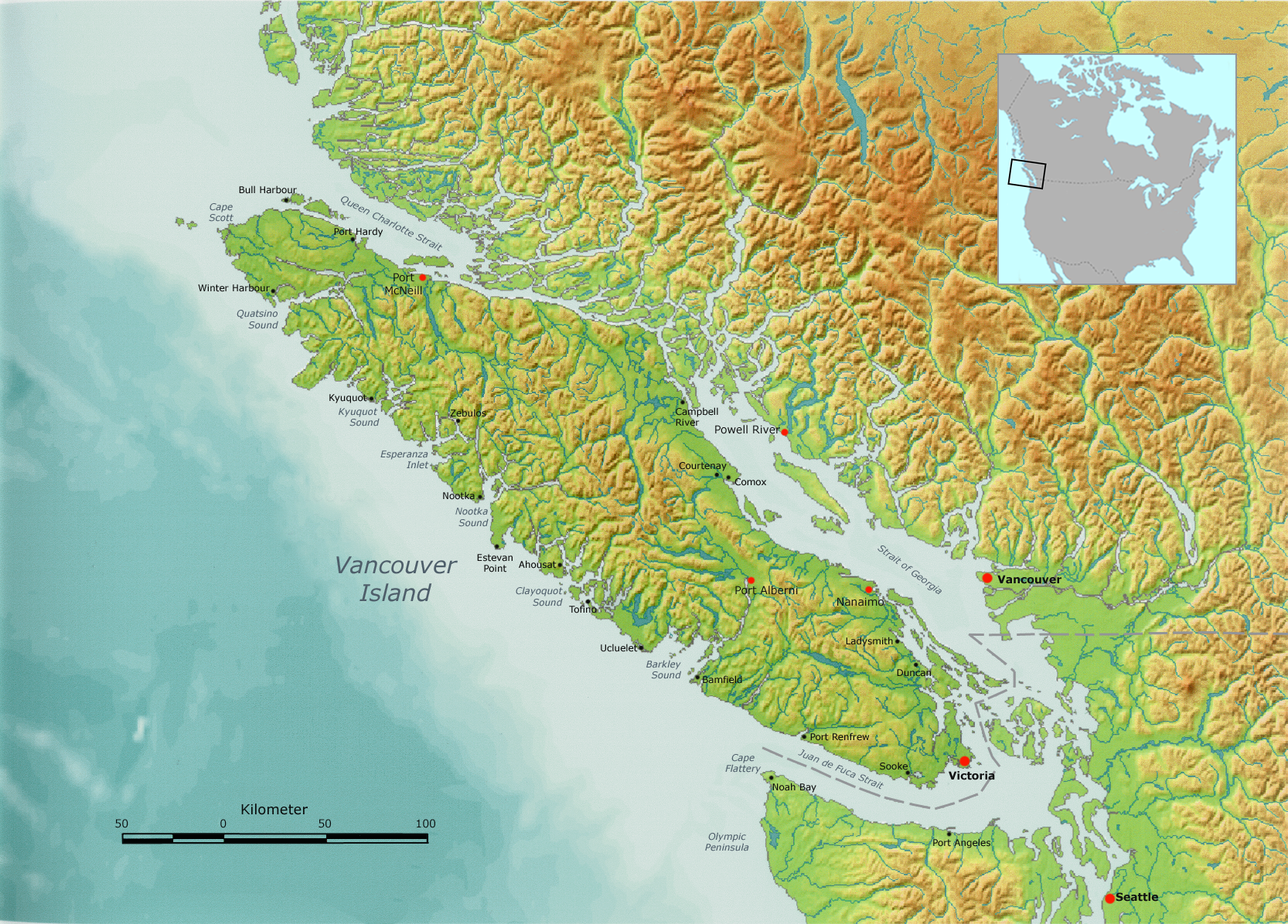
| Description | Vancouver Island, as well as the Canada-US border. | ||||
| Date | |||||
| Source | Own work by Nikater, submitted to the public domain. Background map courtesy of Demis, www.demis.nl. | ||||
| Author | User:Nikater | ||||
| Permission (Reusing this file) |
|
||||
| Other versions | Derivative works of this file: Vancouver Island, with Lasqueti Island highlighted.png |
File history
Click on a date/time to view the file as it appeared at that time.
| Date/Time | Thumbnail | Dimensions | User | Comment | |
|---|---|---|---|---|---|
| current | 09:29, 6 October 2007 | | 1,666 × 1,196 (4.02 MB) | wikimediacommons>Nikater | {{Information |Description=Vancouver Island |Source=Own work by Nikater, submitted to the public domain. Background map courtesy of Demis, www.demis.nl. |Date=6 October 2007 |Author=User:Nikater |Permission={{PD-Demis}} }} |
File usage
The following page uses this file: