File:Screen Shot 2023-09-05 at 12.56.25 PM.png

Size of this preview: 800 × 452 pixels. Other resolution: 1,958 × 1,106 pixels.
Original file (1,958 × 1,106 pixels, file size: 599 KB, MIME type: image/png)
Summary
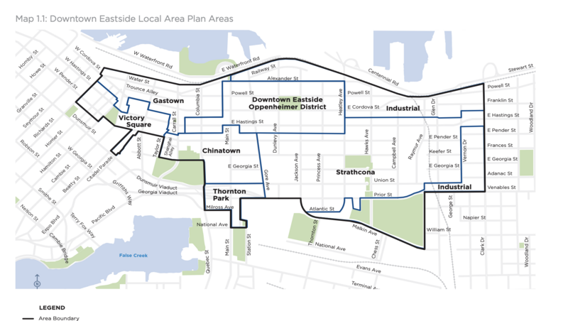
| Description | English: This is a screenshot of the DTES local planning area, comprised of seven sub-areas: Chinatown, Gastown, Industrial Area, Oppenheimer District, Strathcona, Thornton Park and Victory Square (titled Map 1.1 in https://guidelines.vancouver.ca/policy-plan-downtown-eastside.pdf). |
| Date | Jan 1 2014 |
| File source | https://guidelines.vancouver.ca/policy-plan-downtown-eastside.pdf |
| Author | City of Vancouver |
Licensing
|
|
File history
Click on a date/time to view the file as it appeared at that time.
| Date/Time | Thumbnail | Dimensions | User | Comment | |
|---|---|---|---|---|---|
| current | 20:04, 5 September 2023 | | 1,958 × 1,106 (599 KB) | Aleha (talk | contribs) | Uploaded a work by City of Vancouver from https://guidelines.vancouver.ca/policy-plan-downtown-eastside.pdf with UploadWizard |
You cannot overwrite this file.
File usage
There are no pages that use this file.