File:OntarioGreenbelt.png
Size of this preview: 793 × 600 pixels. Other resolutions: 317 × 240 pixels | 635 × 480 pixels | 862 × 652 pixels.
Original file (862 × 652 pixels, file size: 199 KB, MIME type: image/png)
Summary
| Description |
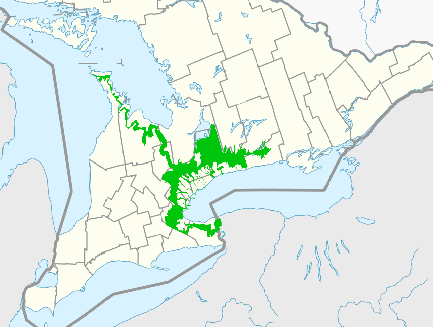
English: The Greenbelt and associated areas prevent development by provincial regulation. These areas in the map all have different designations, but similar effects in preventing most development. Various riparian zones are also protected, but not all are accurately mapped. The map was created with only a modest degree of accuracy. |
| Date | |
| Source | Own work based on: Canada Ontario location map.svg by NordNordWest |
| Author | Kwkintegrator |
Licensing
I, the copyright holder of this work, hereby publish it under the following license:
This file is licensed under the Creative Commons Attribution-Share Alike 4.0 International license.
- You are free:
- to share – to copy, distribute and transmit the work
- to remix – to adapt the work
- Under the following conditions:
- attribution – You must give appropriate credit, provide a link to the license, and indicate if changes were made. You may do so in any reasonable manner, but not in any way that suggests the licensor endorses you or your use.
- share alike – If you remix, transform, or build upon the material, you must distribute your contributions under the same or compatible license as the original.
File history
Click on a date/time to view the file as it appeared at that time.
| Date/Time | Thumbnail | Dimensions | User | Comment | |
|---|---|---|---|---|---|
| current | 04:14, 25 January 2022 | | 862 × 652 (199 KB) | wikimediacommons>Kwkintegrator | Uploaded own work with UploadWizard |
File usage
The following page uses this file: