File:Mount Cain Trail Map.jpg
Size of this preview: 794 × 599 pixels. Other resolution: 1,109 × 837 pixels.
Original file (1,109 × 837 pixels, file size: 165 KB, MIME type: image/jpeg)
Summary
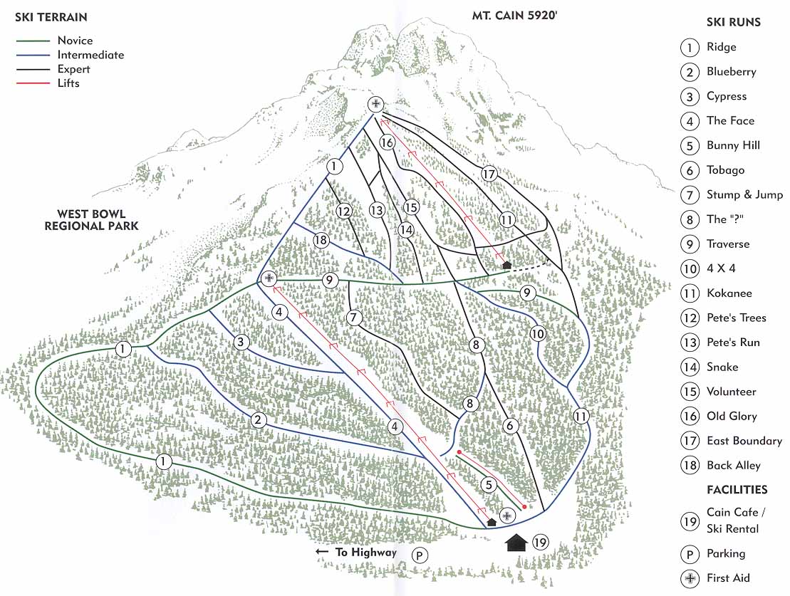
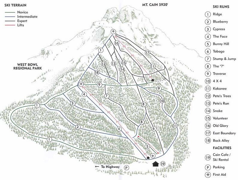
| Description | English: Stylized Tail Map of Mount Cain Ski Area |
| Date | 7 November 2010 |
| File source | https://skimap.org/SkiAreas/view/54 |
| Author | wbski |
Licensing
|
|
File history
Click on a date/time to view the file as it appeared at that time.
| Date/Time | Thumbnail | Dimensions | User | Comment | |
|---|---|---|---|---|---|
| current | 21:35, 15 December 2022 | | 1,109 × 837 (165 KB) | CALEBCOHEN (talk | contribs) | Uploaded a work by wbski from https://skimap.org/SkiAreas/view/54 with UploadWizard |
You cannot overwrite this file.