Uploads by MarieClaireAnderson
This special page shows all uploaded files.
| Date | Name | Thumbnail | Size | Description | Versions |
|---|---|---|---|---|---|
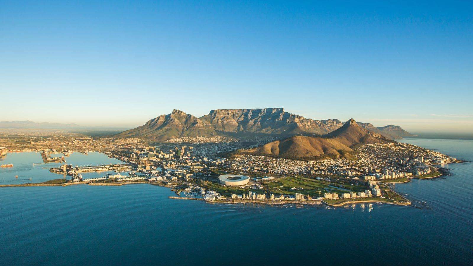
| 20:34, 29 March 2018 | 29748943 1596088823793391 317612775 o.jpg (file) |  |
151 KB | Cape Town aerial shot | 1 |
| 19:12, 29 March 2018 | F366B594-81E4-4F7B-9607-658DB92D911E.jpeg (file) |  |
269 KB | Cape Town | 1 |
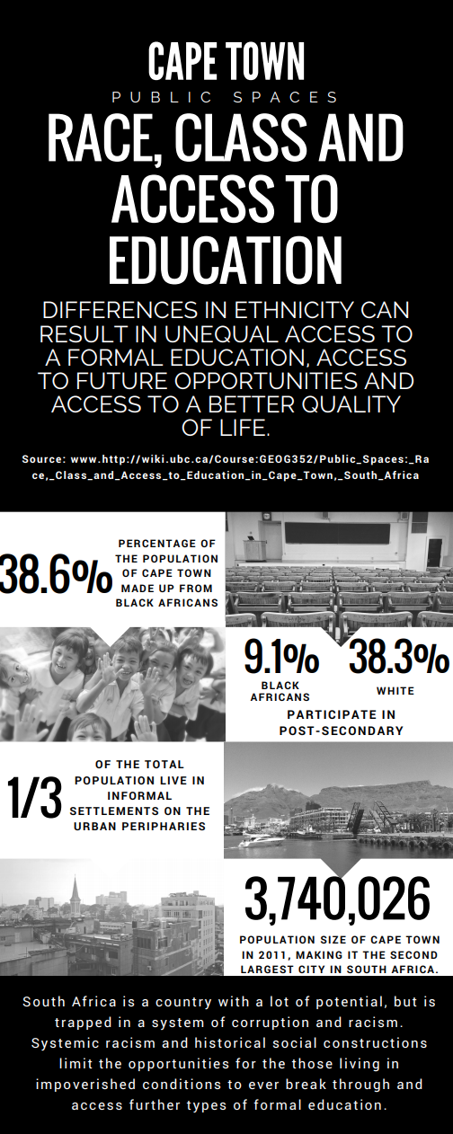
| 19:14, 22 March 2018 | Screen Shot 2018-03-22 at 12.14.22 PM.png (file) |  |
337 KB | Infographic for GEOG352 - Public Spaces: Race, Class and Access to Education | 1 |
| 19:10, 22 March 2018 | Public-Spaces -Race-Class-and-Access-to-Education-in-Cape-Town-South-Africa-2. (1).pdf (file) | 1.62 MB | Infographic for GEOG352 - Public Spaces: Race, Class and Access to Education | 1 | |
| 18:57, 22 March 2018 | Screen Shot 2018-03-22 at 11.55.51 AM.png (file) |  |
226 KB | Partial map of Cape Town illustrating the locations of secondary schools both public and independent in the region. | 1 |
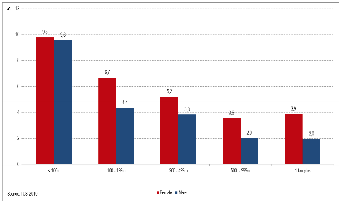
| 18:52, 22 March 2018 | Screen Shot 2018-03-22 at 11.34.23 AM.png (file) |  |
56 KB | Percentage of women and men (without water on site) spending time on water collection, for each distance from the dwelling. | 1 |
| 18:46, 22 March 2018 | Freedom Park location map.jpg (file) |  |
36 KB | Freedom Park location map. | 1 |
| 18:41, 22 March 2018 | 3aa8cc556edc42213aae037b199c73ef.jpeg (file) |  |
202 KB | Gated Community and Shanty Town visualisation. | 1 |