File:Marine Chart for the Strait of Georgia.png

Size of this preview: 602 × 599 pixels. Other resolution: 645 × 642 pixels.
Original file (645 × 642 pixels, file size: 511 KB, MIME type: image/png)
Summary
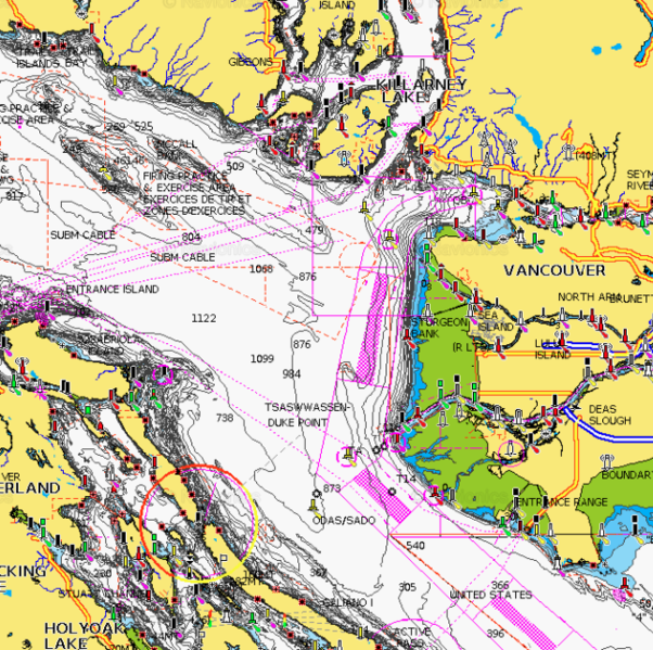
| Description | English: Marine Chart for the Strait of Georgia showing shipping lanes, aids to navigation and traffic schemes for commercial vessels. |
| Date | 10 March 2019 |
| File source | Navionics Chart produce by the Canadian Hydrographic Service |
| Author | Canadian Hydrographic Service |
Template:Location Accessed via Navionics Webapp
Licensing
|
|
File history
Click on a date/time to view the file as it appeared at that time.
| Date/Time | Thumbnail | Dimensions | User | Comment | |
|---|---|---|---|---|---|
| current | 23:38, 10 March 2019 | | 645 × 642 (511 KB) | JohnSmith (talk | contribs) | User created page with UploadWizard |
You cannot overwrite this file.
File usage
The following page uses this file: