File:Dominant land cover and use.png
Size of this preview: 800 × 443 pixels. Other resolution: 979 × 542 pixels.
Original file (979 × 542 pixels, file size: 430 KB, MIME type: image/png)
Summary
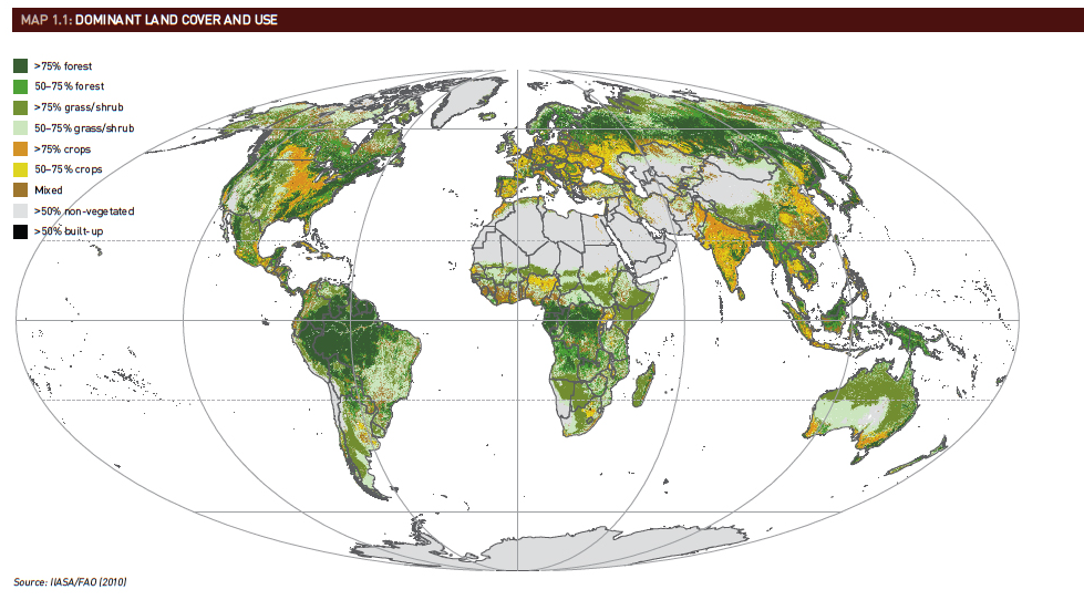
| Description | English: Map for Dominant land cover and use |
| Date | 22 March 2017 () |
| File source | chrome-extension://oemmndcbldboiebfnladdacbdfmadadm/ftp://ftp.fao.org/docrep/fao/011/i0100e/i0100e09.pdf |
| Author | FAO |
Licensing
{{subst:uwl}}
File history
Click on a date/time to view the file as it appeared at that time.
| Date/Time | Thumbnail | Dimensions | User | Comment | |
|---|---|---|---|---|---|
| current | 08:51, 22 March 2017 | | 979 × 542 (430 KB) | HangKinChung (talk | contribs) | User created page with UploadWizard |
You cannot overwrite this file.
File usage
The following page uses this file: