File:Before and after satellite imagery of the region where Belo Monte was built.png

Size of this preview: 800 × 457 pixels. Other resolution: 974 × 556 pixels.
Original file (974 × 556 pixels, file size: 1.31 MB, MIME type: image/png)
Summary
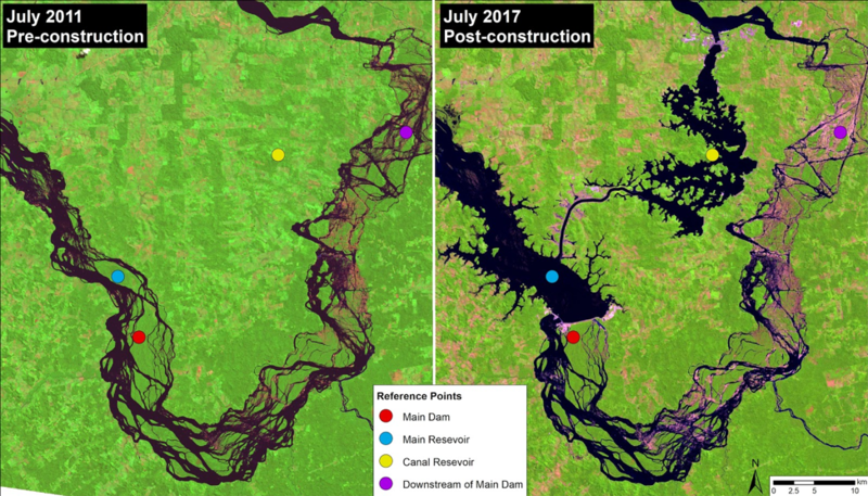
| Description | English: Before and after satellite imagery of the region where Belo Monte was built |
| Date | 4 April 2019 |
| File source | Own Work |
| Author | JinfengWang |
Licensing
|
File history
Click on a date/time to view the file as it appeared at that time.
| Date/Time | Thumbnail | Dimensions | User | Comment | |
|---|---|---|---|---|---|
| current | 22:41, 4 April 2019 | | 974 × 556 (1.31 MB) | JinfengWang (talk | contribs) | User created page with UploadWizard |
You cannot overwrite this file.