Course:GEOG350/Archive/ST1/Surrey
Cloverdale and Whalley, Surrey, BC

Introductions

Surrey is a municipality in Metro Vancouver that has been experiencing drastic development and change over the last few decades. We are studying the effects of crime and social problems on the demographics and movements of population in the districts of the city centre (Whalley) and an up-and-coming suburb, Cloverdale. We expect that people have avoided living in Whalley due to its reputation as an area of high crime and social ailments, and have instead moved to the perceived safety of suburbs like Cloverdale. However, this pattern of those with medium to high income bringing their families (and income) out of the city centre and into suburbs can result in a city centre developing into a sort of ghetto, with crime rates increasing above what would be expected by the increased concentration of poverty.[1] Over the last few decades but especially since the election of mayor Dianne Watts in 2005, Surrey has been working to bring people and money back into Whalley, now called North Surrey or City Centre. Can these efforts improve Whalley's demographic balance, reduce the area's crime rates, and reverse this process of ghettoization?
Neighborhood Analysis
Location
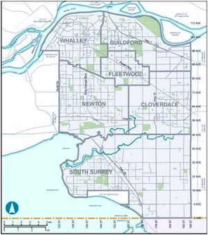
Surrey, the second largest municipality in Metro Vancouver, BC at almost 500,000 residents,[2] is a city in Metro Vancouver located on the southern shore and nearly at the mouth of the Fraser River, bounded to the south by the US border, with Langley to the east and Delta to the west. Of its six town centres, we are comparing Cloverdale and Whalley.
History
Cloverdale

This legendarily clover-filled valley, settled by the Kwantlen and Semiahmoo peoples,[3] is divided between the Nicomekl and Serpentine watersheds, with its downtown climbing the west slope of a hill that is now crowned by the City of Langley. Encircled by Guildford, the City of Langley, South Surrey, Newton, and Fleetwood, Cloverdale began its age of intensive European and Asian development in the 1880's as a stop on the Southern Railway between Bellingham (Washington state), and New Westminster, then the capital of British Columbia.[4] Its quiet growth over the years has been closely tied to the establishment of the area as a farming community, especially for the production of milk.[5] Today, between its borders at 84 avenue, 200 street, 48 avenue, and 152 street, Cloverdale is better known as a filming location, the site of Canada's second-largest rodeo[6] and a burgeoning site for suburban development.[7]
Whalley

The town of Whalley sits in the northeast corner of Surrey, on the south shore of the Fraser River across from the cities of New Westminster and Coquitlam. Whalley's European colonization was established slower than Cloverdale, when the Pacific Highway, also leading into the US, was paved through the area in 1923. Named for its first automobile service station's owner, the town has long aspired to establish itself as a commercial centre for the city of Surrey.[8] By 1976, it was identified as one of the four regional centres of then the Greater Vancouver Regional District. However, as this area has developed as a downtown core, Surrey's negative reputation has largely stemmed from a localized concentration of criminal activity, drug use, poverty, and homelessness.[9]
Demographics
Cloverdale
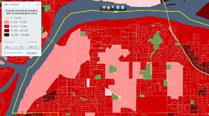
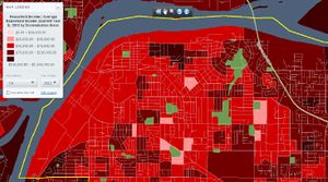
The most populous of Surrey's six town centres (including South Surrey, Newton, Whalley, Fleetwood and Guildford), Cloverdale's 2011 population of approximately 74,000 is of a particular demographic, predominantly married and in 2006 earning an average household income of $91,541, higher numbers than the averages for the rest of Surrey.[10][11] Cloverdale is the fastest growing town within Surrey, its population having grown by about 50% between 2006 and 2011[12] and with some estimates expecting it to grow by about 340% between 2006 and 2041.[13][14]
Whalley
In contrast, Whalley's 2011 population of 60,615 is disproportionately divorced or separated (approximately 10% of adults compared to Surrey-wide 8%), and single-parents (20% of census families), earning an average household income in 2006 of $54,409, less than two thirds that of Cloverdale. From 2006 to 2011, Whalley's population grew by about 15%.[15]
Changes to Neighbourhood Character through Suburbanization
Paul A. Jargowsky and Yoonhwan Park observe that urban centres experience approximately three times the violent crime rates than suburban counties.[16] While their studies took place in larger urban centres, Surrey's reputation reflected this contrast, with Whalley "characterized as a high-crime haven with the normal attendant social problems"[17] while Cloverdale presents itself as "a great place for families".[18] Cloverdale's appeal begins and ends with its status as a suburb, "a collective assertion of class wealth and privilege" that "embodies a new ideal of family life" in the 20th century.[19]
Why?

Middle-class flight is a phenomenon where inner-city crime motivates a "movement of the middle and upper classes to the suburbs."[20] Surrey's own website acknowledges the five main issues facing the city, in descending order: children and youth, housing and homelessness, community development and inclusion, crime and public safety, and substance abuse and addictions.[21][22] Thus Whalley would be categorized by Jargowsky and Park as an area that experiences "concentrations of social and economic problems"; its lower average income compared to Cloverdale reflects the "concentration of poverty" that "creates an environment within which criminal behavior becomes normative".[23] Indeed, Whalley's reputation has extended to give all of Surrey a poor image as "a place that too often made the news for crime".[24] Once this reputation is in place, it demands enormous effort to change. Residents leave the area, new immigrants avoid it, and businesses either wither away or can't endure the theft and vandalism. The area degrades at an accelerating pace. This, they say, is why allowing such "outcast ghettos" to form, where those at-risk are "trapped in neighbourhoods formed through discrimination and the abdication of state responsibility,"[25] actually exacerbates the same problems that lead to the abandonment of these neighbourhoods by middle-income families and businesses, leaving Whalley in a "reciprocal relationship between suburbanization and crime."[26]
To reverse this process requires that several things happen at once in Whalley: that the victims of this vicious cycle are helped in appropriate ways, that locals participate in initiatives to reclaim their neighbourhoods,[27] and that the area projects its new image sincerely and through multiple mediums.
Cloverdale, on the other hand, can continue to absorb excess immigration and offer an alternative to the pace and density of an urban centre. It may be especially beneficial if Cloverdale, too, opens it doors to social programs, thereby sharing the weight of the projects and giving low-income families the option to settle in areas that already have a reputation as safe and family-oriented neighbourhoods. If a change successfully takes place to the old dynamic, Cloverdale may ultimately even become a source of migration into Whalley, if successive young generations are drawn to a new, vibrant "downtown."
What is being done
It is difficult to predict whether development of a region might be a means of reducing crime, or whether the increased density in areas might actually bring a higher concentration of social issues. It is a delicate task. As mentioned above, Whalley's character has changed drastically under the concentrated efforts of Dianne Watts, mayor of Surrey since 2005. Her mayorship has attacked the issues of Surrey as a whole through a variety of means, especially in an attempt to redirect some of the incredible immigration that has especially been enjoyed by Cloverdale, into Whalley, as there is as of yet no reason to doubt that Surrey will fulfill its predictions of surpassing Vancouver as the most populous city of the region as early as 2023.[28]
The City of Surrey's a multi-layered approach has been focussed on the few square blocks around the King George and Surrey Central SkyTrain stations in Whalley. It attempts a preventative approach to positive development of community, focussing on children and youth from early ages through a three-policy program to develop youth and children as active civic citizens: engagement, physical environment, and civic services. This currently culminates in a youth-facilitated forum that aims to engage young people in community planning issues and to cultivate leadership, while public libraries hold self-improvement programs and partnerships for youth.[29] This demographic is especially important because a full quarter of the residents of Surrey are under 19.[30] Promoting education and literacy has the second benefit of raising a new generation that is better educated than the previous demographics, and especially more employable in the high-tech industries that are being baited into Whalley with deep discounts to property taxes, business licenses, and building permits.[31]
As for homelessness, under the Surrey Poverty Reduction Plan, the City is partnering with BC Housing by contributing land and waiving development fees on three projects: a 26-unit YWCA building for at-risk women; a transition centre for people with addictions that also treats mental health issues;[32] and an apartment complex for individuals at risk of homelessness.[33]

To reduce poverty, the Watts council's plan focuses on encouraging transit-oriented communities, advocating for a national housing strategy, increasing "the supply of non-market and social housing", and ensuring affordability of market rental housing. They aim to promote local economic development and the adoption of a living wage by employers. The need to aid recent immigrants in settling is acknowledged, as a part of building "a healthy and inclusive community."[34]
Indeed, average incomes have risen steadily, though following a trend that was already present in the '90's. However, while Cloverdale's average income increased by over 60% between 2001 and 2006, that of Whalley increased by less than 45%.[35] Is this trend changing now? According to an article that very recently appeared in BC Business magazine, it is. The author quotes Mayor Dianne Watts, the CEO of Surrey's own development corporation, and various members of the City's favorite architecture firms, all optimistic. The article describes the city as being "built from the ground up", a thin line as discussed in our text, as imposed gentrification displaces original residents, as has happened in many areas of Vancouver, as well as the early-wave gentrifiers who had been grateful for the cheap rent of a run-down area.[36] The article points out that Surrey remains far more affordable than Vancouver, but the comparison is unfair; the average income of Whalley residents, where the vast majority of the development is taking place, today remains lower than even other areas of Surrey. This is not to mention that much of what Surrey has to offer lies in its "great swaths of buildable land"[37] - perhaps referring to that which is perceived today as underused, lying under farmland and the last fragments of wildlife habitat; the article's mention of the Agricultural Land Reserve, or ALR, once the mainstay of the municipality's economy, is but momentary.
Still, according to Watts, about 2,000 new businesses open in Surrey each year, and 1,200 new residents move in each month. Is this the solution to "the poorly conceived sprawl that was the suburban wasteland of strip malls, auto wreckers and cheap housing" of before?[38] Surrey is certainly changing, with a barely-recognizable Whalley at the centre of the flurry. The momentum seems to be enough to extract the city from the vicious cycle of social problems and negative image, and propel it into a new stage.
References
- ↑ Jargowsky, Paul A. & Yoonhwan Park. "Cause or Consequence? Suburbanization and Crime in U.S. Metropolitan Areas." Crime & Delinquency, 55. 2009. p 24. ((Ava))
- ↑ "Population and dwelling counts, for Canada and census subdivisions (municipalities), 2011 and 2006 censuses." Statistics Canada: Canada's national statistical agency. N.p., n.d. Web. 15 July 2013. <http://www12.statcan.gc.ca/census-recensement/2011/dp-pd/hlt-fst/pd-pl/Table-Tableau.cfm?LANG=Eng&T=301&S=3&O=D> ((Joe and Ava))
- ↑ Enomoto, Randy & Genevieve Fuji Johnson (2007). Race, Racialization and Antiracism in Canada and Beyond. Toronto: University of Toronto Press Incorporated. ((Ava))
- ↑ “Cloverdale History”. Cloverdale Online. n.p., n.d. Web. May 2012.<http://www.cloverdale.bc.ca/> ((Nikhil and Ava))
- ↑ Cloverdale Town Centre: Land use and urban design concept plan (2000). Surrey, BC: City of Surrey.<http://www.surrey.ca/files/CloverdaleTownCentreLandUseandUrbanDesign.pdf>
- ↑ “Cloverdale History”. Cloverdale Online. n.p., n.d. Web. May 2012.<http://www.cloverdale.bc.ca/>
- ↑ “Cloverdale”. Surrey. n.p., n.d. Web. 2013.<http://www.surrey.ca/community/6799.aspx>
- ↑ "Whalley." City of Surrey. N.p., n.d. Web. 11 July 2013. <http://www.surrey.ca/culture-recreation/2409.aspx>
- ↑ Brenzinger, Elayne. "Surrey-Whalley." ProQuest 1 (2005): n. pag. ProQuest. Web. 1 July 2013. ((Nikhil))
- ↑ "2011 Census Profile for British Columbia Provincial Electoral Districts - 2008 Representation Order" ((Joe and Ava))
- ↑ "British Columbia Provincial Electoral District Profile for Surrey-Cloverdale Based on the 2006 Census" ((Joe and Ava))
- ↑ "2006 Census Semi-custom Profile of British Columbia Provincial Electoral Districts (2008 Distribution)"
- ↑ "Key Indicators - BC Stats." BC Stats Home - BC Stats. N.p., n.d. Web. 15 July 2013. <http://www.bcstats.gov.bc.ca/StatisticsBy ((Joe and Ava))
- ↑ “Cloverdale Demographics”. Cloverdale Online. n.p., n.d. Web. May 2012.<http://www.cloverdale.bc.ca/chamber/demographics.php/ ((Joe))
- ↑ "British Columbia Provincial Electoral District Profile for Surrey-Whalley Based on the 2006 Census" ((Joe and Ava))
- ↑ Jargowsky, Paul A. & Yoonhwan Park. "Cause or Consequence? Suburbanization and Crime in U.S. Metropolitan Areas." Crime & Delinquency, 55. 2009. p 28. ((Ava))
- ↑ Little, Lyndon. The Vancouver Sun [Vancouver, B.C] 14 May 2005: L12. ((Nikhil))
- ↑ "Welcome to Cloverdale." Cloverdale Online. N.p., n.d. Web. 7 Aug. 2013. <http://www.cloverdale.bc.ca/>.((Ava))
- ↑ Fishman, Robert. "Bourgeois Utopias: Visions of Suburbia." 1987. pp 21-22. ((Ava))
- ↑ Jargowsky, Paul A. & Yoonhwan Park. "Cause or Consequence? Suburbanization and Crime in U.S. Metropolitan Areas." Crime & Delinquency, 55. 2009. p 28. ((Ava))
- ↑ "Plan for the Social Well-Being of Surrey Residents." The City of Surrey. N.p., n.d. Web. 15 July 2013. <http://www.surrey.ca/community/3194.aspx> ((Nikhil))
- ↑ "Poverty and Crime: Breaking the Vicious Circle." Research on Poverty for Social & Economic Development. N.p., n.d. Web. 21 June 2013. <http://www.poverties.org/poverty-and-crime.html> ((Nikhil))
- ↑ Jargowsky, Paul A. & Yoonhwan Park. "Cause or Consequence? Suburbanization and Crime in U.S. Metropolitan Areas." Crime & Delinquency, 55. 2009. p 24. ((Ava))
- ↑ Gold, Kerry. "Surrey, the Startup City?" BC Business. August 5, 2013. Page 3. ((Joe and Ava))
- ↑ "Chapter 10: New Divisions: Social polarization and neighbourhood inequality in the Canadian city." Canadian Cities in Transition: New directions in the twenty-first century. 4th ed. Trudi Bunting, Pierre Filion & Ryan Walker, ed.s. p 182 ((Ava))
- ↑ Jargowsky, Paul A. & Yoonhwan Park. "Cause or Consequence? Suburbanization and Crime in U.S. Metropolitan Areas." Crime & Delinquency, 55. 2009. p 36. ((Ava))
- ↑ Bain, Alison. "Chapter 15: Re-Imaging, Re-Elevating, and Re-Placing the Urban." Canadian Cities in Transition: New directions in the twenty-first century. 4th ed. Trudi Bunting, Pierre Filion & Ryan Walker, ed.s. p 271. ((Ava))
- ↑ Bennett, Jill. "Surrey’s population projected to surpass Vancouver’s | Globalnews.ca." Global News. N.p., n.d. Web. 15 July 2013. <http://globalnews.ca/news/653206/surreys-population-projected-to-surpass-vancouvers/> ((Nikhil))
- ↑ "Child & Youth Friendly City Strategy :: The City of Surrey, British Columbia."City of Surrey :: The City of Surrey, British Columbia. N.p., n.d. Web. 20 June 2013. <http://www.surrey.ca/community/3191.a ((Nikhil))
- ↑ "Child and Youth Friendly City Strategy - Update on Initiatives." City of Surrey. N.p., Web. 23 July 2012. <www.surrey.ca/files/CR_2012-R184.pdf>.((Nikhil and Ava))
- ↑ Gold, Kerry. "Surrey, the Startup City?" BC Business. August 5, 2013. Page 1. ((Joe and Ava))
- ↑ Watts, Dianne. "Surrey crime strategy unveiled." ProQuest 1 (2013): 3. Proquest. Web. 19 June 2013
- ↑ "Partnerships with BC Housing :: The City of Surrey, British Columbia." City of Surrey :: The City of Surrey, British Columbia. N.p., n.d. Web. 7 Aug. 2013. <http://www.surrey.ca/community/3176.aspx>. ((Nikhil))
- ↑ "Surrey Poverty Reduction Plan." City of Surrey. N.p., n.d. Web. 1 July 2012. <http://www.surrey.ca/files/Surrey_Poverty_Reduction_Plan_Web_Version.pdf ((Nikhil))
- ↑ " Census of Canada - BC Stats." BC Stats Home - BC Stats. N.p., n.d. Web. 7 Aug. 2013. <http://www.bcstats.gov.bc.ca/StatisticsBySubject/Census.aspx>. ((Joe))
- ↑ Bain, Alison. "Chapter 15: Re-Imaging, Re-Elevating, and Re-Placing the Urban." Canadian Cities in Transition: New directions in the twenty-first century. 4th ed. Trudi Bunting, Pierre Filion & Ryan Walker, ed.s. p 270. ((Ava))
- ↑ Gold, Kerry. "Surrey, the Startup City?" BC Business. August 5, 2013. ((Joe and Ava))
- ↑ Ibid.
Group Members
Agarwal, Nikhil
Shannon, Ava
Van Vliet, Joe