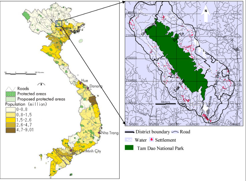
File:Tam Dao National Park Map.png

Size of this preview: 800 × 590 pixels. Other resolution: 924 × 682 pixels.
Original file (924 × 682 pixels, file size: 448 KB, MIME type: image/png)
Summary
| Description | English: Map of the national park |
| Date | 19 June 2014 |
| File source | Khoi, D. D., & Murayama, Yuji. (2010). Forecasting Areas Vulnerable to Forest Conversion in the Tam Dao National Park Region, Vietnam. Remote Sensing, 2(5), 1249-1272. doi:10.3390/rs2051249 |
| Author | Khoi, D. D., & Murayama, Yuji |
Licensing
|
|
File history
Click on a date/time to view the file as it appeared at that time.
| Date/Time | Thumbnail | Dimensions | User | Comment | |
|---|---|---|---|---|---|
| current | 03:22, 27 November 2018 | | 924 × 682 (448 KB) | BenjaminEisner (talk | contribs) | |
| 00:27, 27 November 2018 | Error creating thumbnail: File with dimensions greater than 12.5 MP | 4,303 × 3,396 (1.58 MB) | BenjaminEisner (talk | contribs) | User created page with UploadWizard |
You cannot overwrite this file.
File usage
The following page uses this file: