File:Proposed Street Network.png
No higher resolution available.
Proposed_Street_Network.png (624 × 340 pixels, file size: 110 KB, MIME type: image/png)
Summary
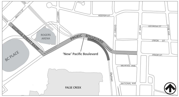
| Description | English: Proposed street network linking Georgia Street ramp to Pacific Boulevard, ultimately unifying with Expo Boulevard north of the Skytrain guideway. |
| Date | 7 August 2013 |
| File source | Own Work |
| Author | Patrick Hay |
Licensing
|
File history
Click on a date/time to view the file as it appeared at that time.
| Date/Time | Thumbnail | Dimensions | User | Comment | |
|---|---|---|---|---|---|
| current | 20:56, 7 August 2013 | | 624 × 340 (110 KB) | PatrickHay (talk | contribs) | |
| 20:52, 7 August 2013 |  | 625 × 377 (114 KB) | PatrickHay (talk | contribs) |
You cannot overwrite this file.
File usage
The following page uses this file: