File:Karimunjawa shallow reef.jpg
Size of this preview: 800 × 600 pixels. Other resolutions: 320 × 240 pixels | 640 × 480 pixels | 1,024 × 768 pixels | 1,280 × 960 pixels | 2,560 × 1,920 pixels | 3,648 × 2,736 pixels.
Original file (3,648 × 2,736 pixels, file size: 2.81 MB, MIME type: image/jpeg)
Summary
| Description |
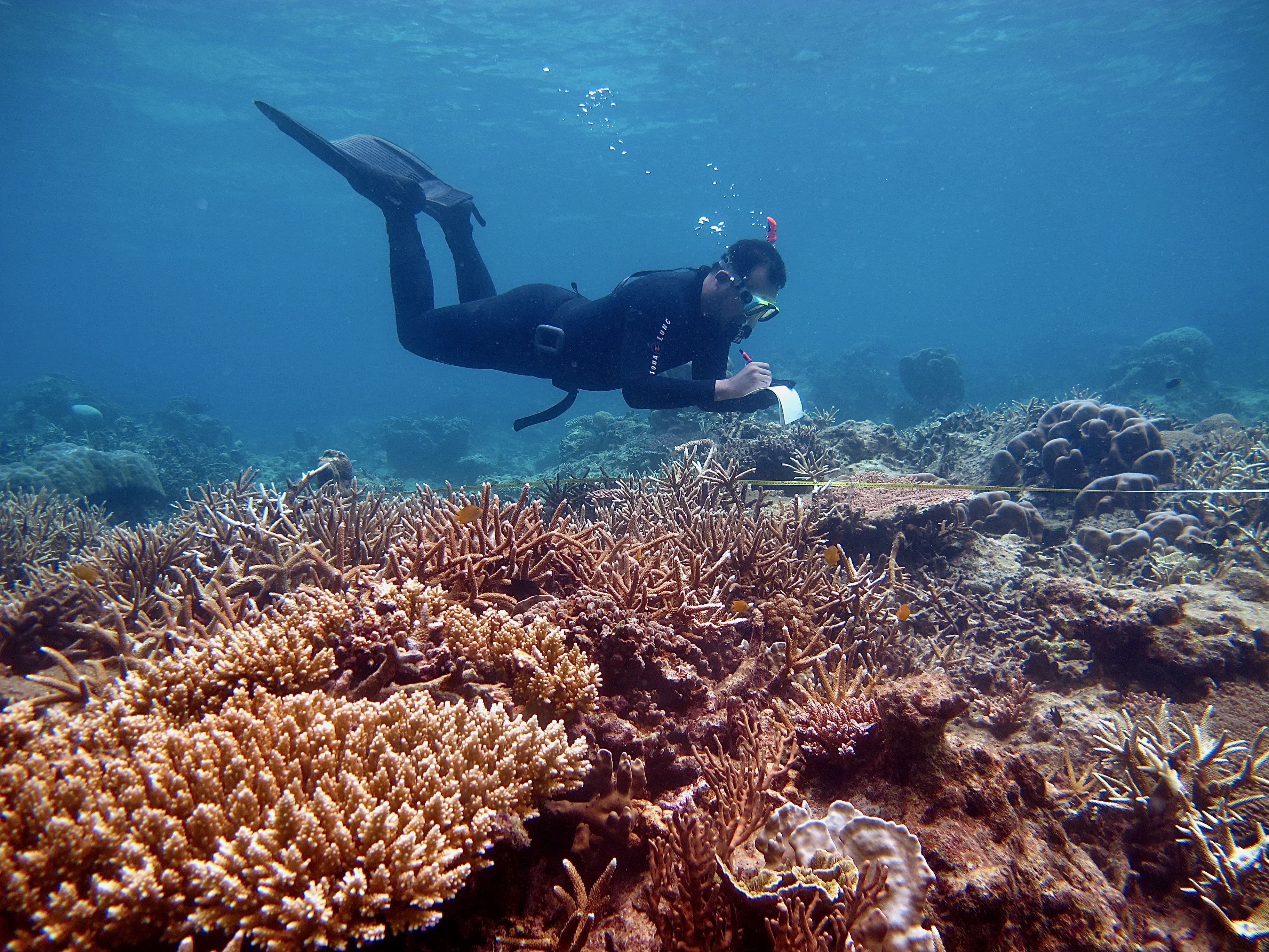
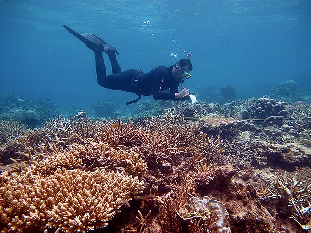
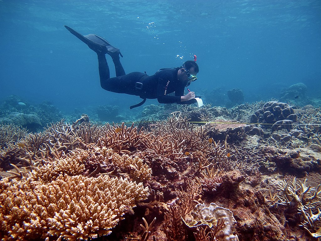
English: A scientific diver was collecting data on coral reef ecosystem of the Karimunjawa National Park, Central Java, Indonesia. |
| Date | |
| Source | Own work |
| Author | Fakhrizal Setiawan |
| Camera location | | View this and other nearby images on: OpenStreetMap |
|---|
Taman Nasional Karimunjawa secara geografis terletak pada koordinat 5°40’39”- 5°55’00” LS dan 110°05’ 57”-110°31’ 15” BT. Dalam Surat Keputusan Menteri Kehutanan dan Perkebunan No. 78/Kpts-II/1999 tanggal 22 Februari 1999 dinyatakan bahwa kawasan Cagar Alam Karimunjawa dan sekitarnya yang terletak di Kabupaten Dati II Jepara Propinsi Dati I Jawa Tengah ditetapkan menjadi Taman Nasional dengan nama TAMAN NASIONAL KARIMUNJAWA dengan luasan kawasan adalah 111.625 hektar
Licensing
I, the copyright holder of this work, hereby publish it under the following license:
This file is licensed under the Creative Commons Attribution-Share Alike 4.0 International license.
- You are free:
- to share – to copy, distribute and transmit the work
- to remix – to adapt the work
- Under the following conditions:
- attribution – You must give appropriate credit, provide a link to the license, and indicate if changes were made. You may do so in any reasonable manner, but not in any way that suggests the licensor endorses you or your use.
- share alike – If you remix, transform, or build upon the material, you must distribute your contributions under the same or compatible license as the original.
This image was uploaded as part of Wiki Loves Earth 2020. Other languages:
|
 |
File history
Click on a date/time to view the file as it appeared at that time.
| Date/Time | Thumbnail | Dimensions | User | Comment | |
|---|---|---|---|---|---|
| current | 12:47, 3 May 2020 | | 3,648 × 2,736 (2.81 MB) | wikimediacommons>Rizalubun | Uploaded own work with UploadWizard |
File usage
The following page uses this file: