File:Ecoregions and Biomes of Colombia.png
Size of this preview: 455 × 600 pixels. Other resolution: 850 × 1,120 pixels.
Original file (850 × 1,120 pixels, file size: 548 KB, MIME type: image/png)
Summary
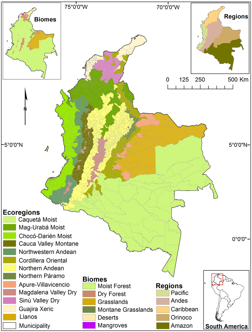
| Description | English: Map of Colombia's 13 ecoregions, 6 biomes and 5 regions (excluding Insular Caribbean and Pacific islands). Inset map shows Colombia's location within South America. |
| Date | August 2012 |
| File source | Land Cover Change in Colombia: Surprising Forest Recovery Trends between 2001 and 2010 |
| Author | A.M. Sánchez Cuervo et al. |
Licensing
|
|
File history
Click on a date/time to view the file as it appeared at that time.
| Date/Time | Thumbnail | Dimensions | User | Comment | |
|---|---|---|---|---|---|
| current | 03:21, 6 December 2022 | | 850 × 1,120 (548 KB) | MackenzieFrancesStewart (talk | contribs) | Uploaded a work by A.M. Sánchez Cuervo et al. from Land Cover Change in Colombia: Surprising Forest Recovery Trends between 2001 and 2010 with UploadWizard |
You cannot overwrite this file.
File usage
The following page uses this file: