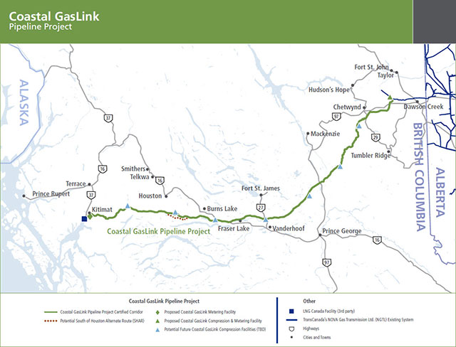
File:Coastal-GasLink-Alternate-Route-Map-Labeled.jpg
No higher resolution available.
Coastal-GasLink-Alternate-Route-Map-Labeled.jpg (640 × 488 pixels, file size: 62 KB, MIME type: image/jpeg)
Summary
| Description | English: Mapped Route of the Coastal GasLink Pipeline |
| Date | 1 April 2019 |
| File source | http://www.coastalgaslink.com/about/route-maps/ |
| Author | TransCanada Corporation |
Licensing
|
|
File history
Click on a date/time to view the file as it appeared at that time.
| Date/Time | Thumbnail | Dimensions | User | Comment | |
|---|---|---|---|---|---|
| current | 05:07, 2 April 2019 | | 640 × 488 (62 KB) | AmyLamprecht (talk | contribs) | User created page with UploadWizard |
You cannot overwrite this file.
File usage
The following page uses this file: