File:Carpathian map.jpg

Size of this preview: 797 × 599 pixels. Other resolution: 799 × 601 pixels.
Original file (799 × 601 pixels, file size: 332 KB, MIME type: image/jpeg)
Summary
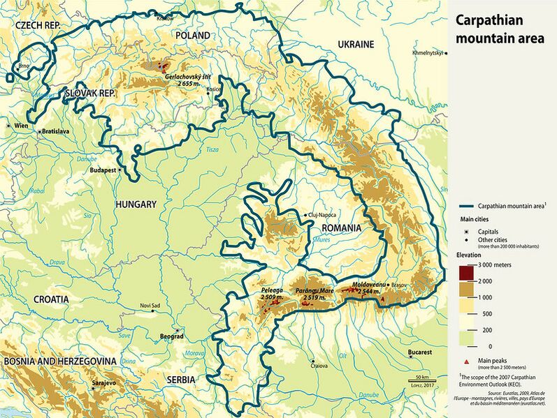
| Description | English: A map of the Carpathian Mountain ranges running through Poland, Ukraine and Romania. |
| Date | 12 October 2017 |
| File source | https://www.flickr.com/photos/gridarendal/36940380404 |
| Author | GRID Arendal |
Licensing
|
|
File history
Click on a date/time to view the file as it appeared at that time.
| Date/Time | Thumbnail | Dimensions | User | Comment | |
|---|---|---|---|---|---|
| current | 19:11, 28 November 2019 | | 799 × 601 (332 KB) | XuedanXu (talk | contribs) | User created page with UploadWizard |
You cannot overwrite this file.
File usage
The following page uses this file: